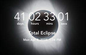
And so we continue preparations for the April 8 solar eclipse in Ingram Texas! Before actually testing equipment we wanted to firm up a couple of important organizational items. First off is the actual official contact times for our intended location. We will update these when we get to actual site but there are potential timing “gotchas” that could happen in this case.
Number one is that here in the US we insist on changing clock times creating the annoying “Daylight Savings Time” vs “Standard Time”. This year daylight savings occurs on March 11, so clocks move ahead one hour. Number two is that we are going to be traveling to the observing site in the next time zone east of us so we will be technically in Central Daylight Time. Thankfully the calculated contact times are in Universal Time. However if you are using the “Eclipse Timer App” on your phone (to be discussed in a later post) and you load the contact times now, they will be off by one hour. You need to check another way.
“Universal Time” is mean time for the meridian at Greenwich, England (0° longitude), which runs through the former site of the Royal Observatory. It is based on the sidereal period of Earth’s rotation and is used as a basis for calculating standard clock time throughout most of the world. It is also called “Greenwich Mean Time”. All it means practically for us is we need to know how many hours west of the Greenwich Meridian we are going to be at to calculate the local times of the eclipse events.
On April 8 this year we will be in the Central Time Zone for the US which will be 5 hours west (EARLIER) than the Universal Time taking into account we will be in Central Daylight Time thanks to daylight savings!
So we need to know:
- The real contact times we can expect
- Where the Sun will be in the sky
- Where the Moon will be coming from
- Where on the Sun’s limb the photographic events are going to happen
- When the Sun will cross the meridian
To do this we make use of this fantastic resource which is an Eclipse Interactive Google Map created by Javier M. Jubier.
First click on the eclipse to observe as shown above.
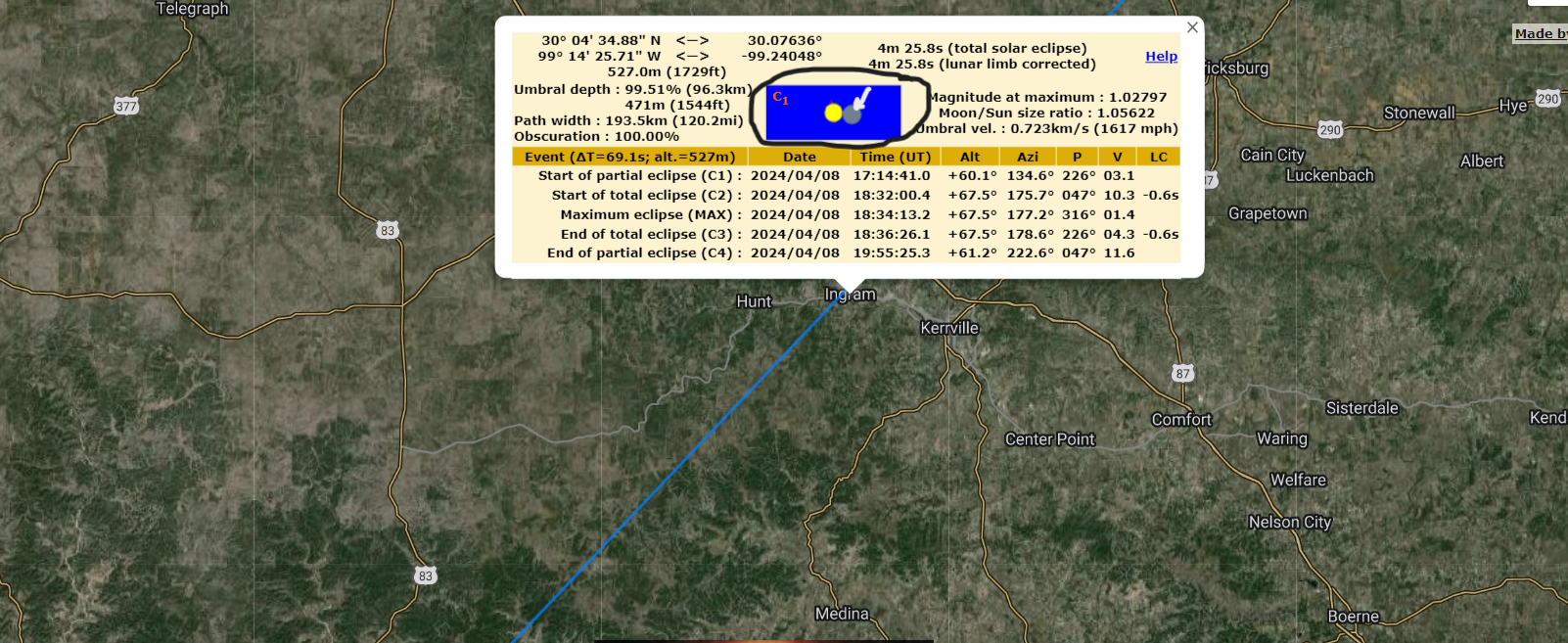
When you click on the eclipse date you are taken to the Google map. There you find your observing site and click on it. Like magic, the contact times are presented as shown! Just to review, ‘C1’ or First Contact is the beginning of the partial eclipse, when the Moon just starts to cross the Sun’s disc. You can see the Moon there in the graphic (white arrow) which is telling us the moon begins to cross the disc going from right to left.
Now looking at the times we see that the start of total eclipse ‘C2’ occurs at 18:32 Universal Time which would be 1:32 PM (13:32) local time, arrived at by subtracting 5 hours for our time zone.. This seems correct since our initial estimate was around 1:30 local time. The eclipse duration is around 4+ minutes, also correct.
So we now have confirmed the correct contact times and we also know which direction the Moon is coming from.
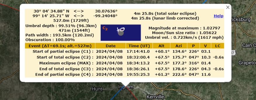
The above graphic shows the appearance of the sun at C2 which is the very beginning of totality, however the few brief seconds before complete coverage is when all of the events we want to capture will occur before the corona! This includes Baily’s Beads and diamond ring effect which we covered in an earlier post. The white arrow shows the simulated diamond ring which is happening in the left upper quadrant. The white circle surrounds a red tick mark in the graphic showing us where the solar north is going to be.
In this display above we can see that we will have to slightly rotate the camera (blue square) so the C2 events (and C3 at the end repeated) will be aligned centrally in the frame from left to right. Now you could also determine this when the partial phases begin and of course if it’s still rotated you can always correct this during processing 🙂 But it is helpful to know where you will be looking ahead of time.
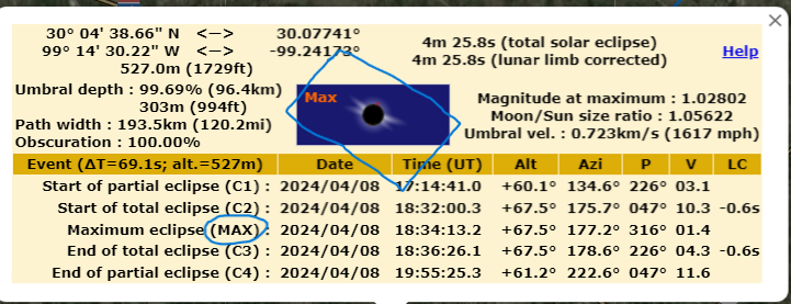
If you click on any of the contact times in parentheses (circled above), this is actually a hyperlink that will take you the “Peak Finder” page displaying the location of the Sun with respect to the landscape. Now for us it’s not going to be that useful because we can already see the Sun will be very high in the sky (about 68 degress altitude). If you were planning a wider field view and totality was occurring more toward sunset let’s say, this could be very helpful.

Finally we are going to need at least a reasonable estimate of when the Sun will cross the meridian (basically highest point in the sky that separates east and west). We are going to be using a tracking (equatorial) mount and at some point after meridian crossing the mount will stop tracking until it gets “flipped” to the east side of the meridian so it can track west. If this happens mid eclipse that could be a major problem.
Above is a table of data from the US Naval Observatory that seems to indicate solar meridian crossing (also known as “transit”) will occur at 13.39 on April 8. This is 1:39PM. So it’s pretty close but probably not going to be a problem since totality is expected to end 3 minutes earlier. What we will have to include in our testing is how long the mount will track past the meridian. This will be very important!
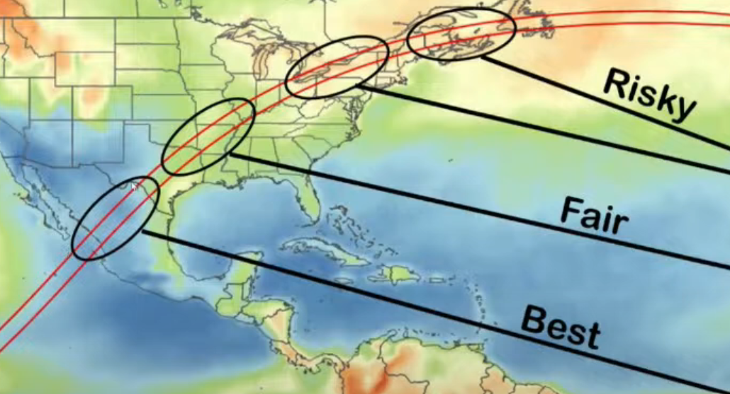
And finally just a rough weather projection which shows the eclipse path and chances of inclement weather on eclipse day. We will be on the lower end of “Fair” which means we have a slightly better that 50% chance of good weather. Because of the enormous crowds anticipated along the eclipse path, which contains several metropolitan areas, I will be somewhat skeptical of our chances to successfully relocate at the last minute but nothing will be entirely ruled out!
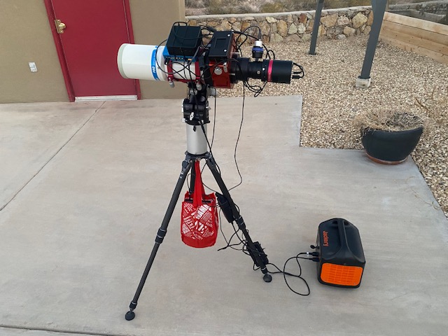
I believe all the preliminaries are in order so next is the actual equipment preparations!
Thanks for reading!
DrDave